Our Premium Chart Offering
- Derived from official charts and private sources to provide navigational aids, spot soundings, depth contours, tides and currents, and detailed harbors and marinas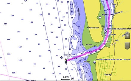
Auto Guidance¹
Auto Guidance technology from Garmin quickly calculates a suggested route using your boat's dimensions and a suggested path to follow.
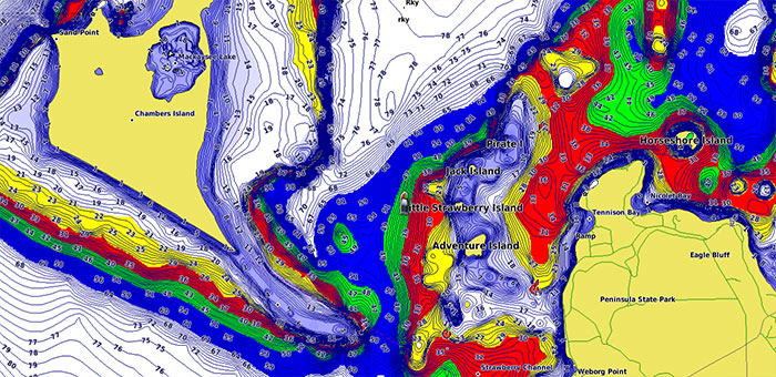
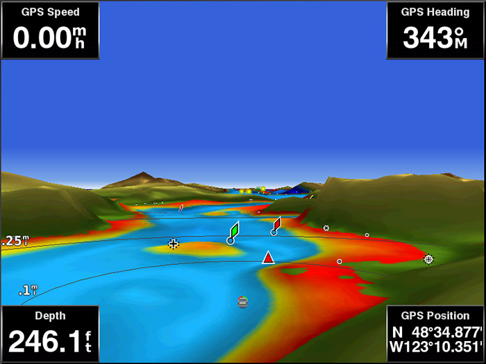
Depth Range Shading
Displays high-resolution Depth Range Shading for up to 10 depth ranges so you can view your designated target depth.
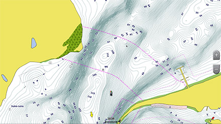
Detailed Contours
BlueChart g2 Vision HD features 1-foot contours that provide a more accurate depiction of bottom structure for improved fishing charts and enhanced detail in swamps, canals and port plans.
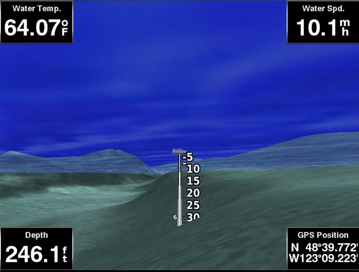
Marinerseye View
Provides a 3D representation of the ocean floor as seen from below the waterline.
Fisheye View
Provides a 3D representation of the surrounding area both above and below the waterline.
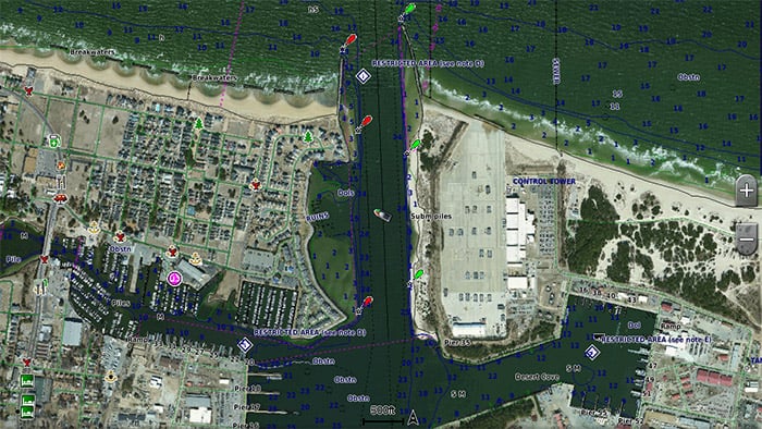
High-Resolution Satellite Imagery
High-resolution satellite imagery with navigational charts overlaid gives you a realistic view of your surroundings so you can navigate with a clear moving-chart representation of your boat's position. It's our most realistic charting display in a chartplotter.
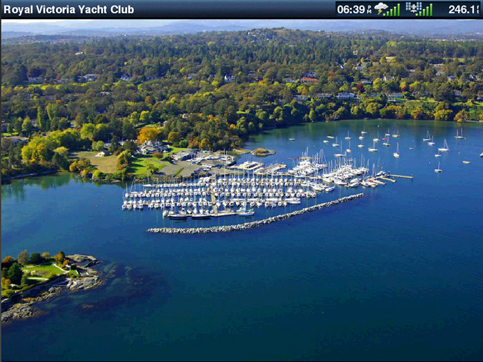
Aerial Photography
Crystal clear aerial photography shows exceptional detail of many ports, harbors and marinas and is ideal when entering unfamiliar ports.
¹Auto Guidance is for planning purposes only and does not replace safe navigation practices.
In the Box
- Garmin BlueChart g2 Vision Micro SD/SD Card - South Africa
Compatible Devices
| EAN/UPC code | 753759069285 |
|---|---|
| Manufacturer | Garmin |
| Product Source | Garmin Southern Africa |